Business and ServicesSolution
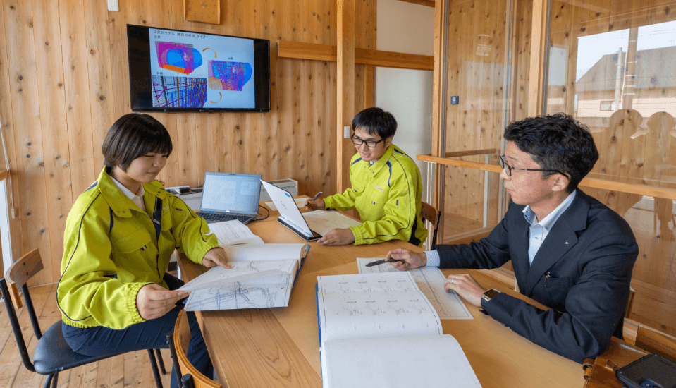
Measuring the region and building a town
Connecting to the future
Futaba's business has overcome the Great East Japan Earthquake in the Hamadori area of Fukushima Prefecture and is expanding into new areas.
From "hard" projects centered on surveying and designing social infrastructure development, to "soft" projects that connect people and communities,
We respond to the diverse needs of our customers and solve the many local issues that are piling up with the power of people and technology.
We aim to become "social consultants" who can use this power to solve global issues.
Futaba ServicesFutaba's services
Construction Consulting
Leveraging the strengths of local companies
Contributing to solving local issues
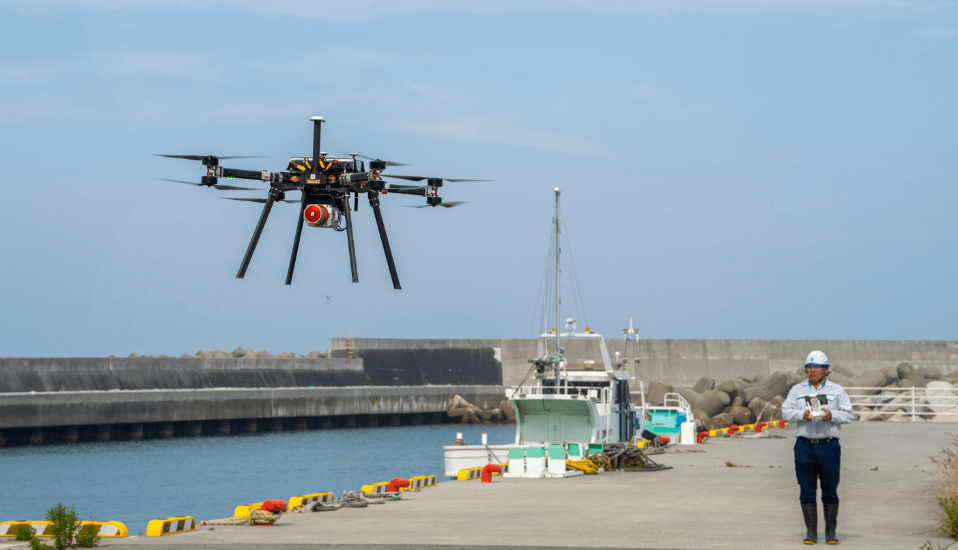
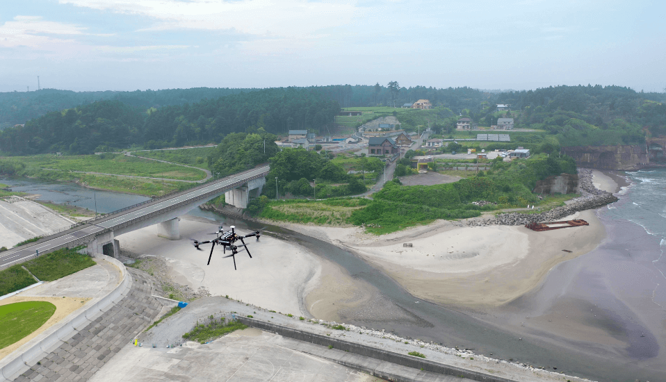
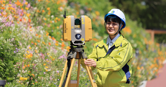
Surveying and site investigation
Capturing the needs of the times
Providing cutting-edge surveying technology
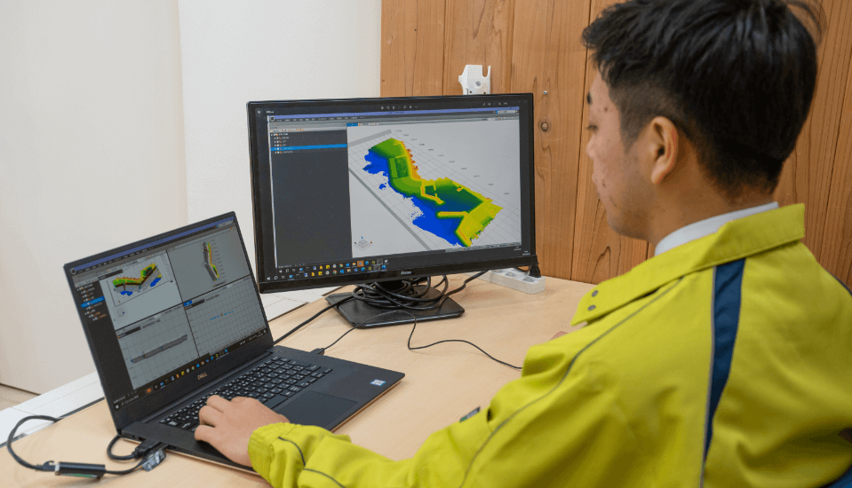
Spatial information consulting
By promoting digital transformation and utilizing remote sensing technology
Promoting reconstruction and revitalization
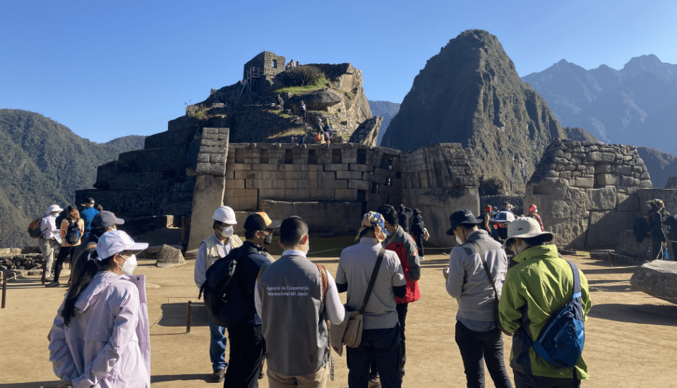
Overseas Consulting
Fukushima technology to the world
Bringing global experience to Fukushima
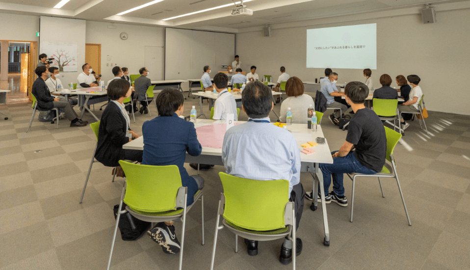
Regional Design (Urban Development)
To create an attractive region
Proposing urban development
Futaba ToolsFutaba's tools
The latest technology that meets the needs of the times
Based on our many years of experience in the field of surveying and design,
i-Construction and BIM/CIM, etc., tailored to the needs of the times
We proactively incorporate new technologies and offer technical capabilities in a wide range of fields.
 Futaba Solution YouTube
UAV-mounted green laser scanner
By installing a green laser scanner on a UAV, it is possible to measure the underwater topography using a green laser that penetrates water. The depth measurement distance depends on the transparency of the water.
UAV-mounted 3D laser scanner
By surveying using a UAV equipped with a near-infrared laser scanner, it is possible to measure 3D point cloud data including the ground surface, even in areas with dense vegetation, as the laser can pass through gaps between the branches and leaves.
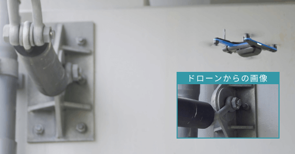
Inspection UAV
It can be autonomously controlled even in environments where GPS is not available. It is equipped with an omnidirectional obstacle detection system that utilizes Visual SLAM, which is less susceptible to magnetic interference, allowing for safe close-up photography.
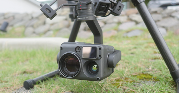
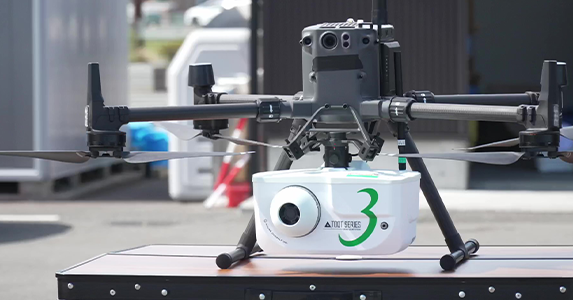
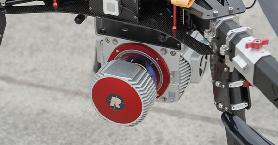
UAV-mounted multi-function camera
Equipped with a wide-angle camera, a zoom camera, a thermal camera, and a laser rangefinder, it can be used for maintaining structures, investigating large animals, and obtaining coordinate information of objects.
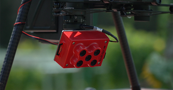
Multispectral camera
By installing a multispectral camera on a UAV, it is possible to capture images in five bands (Blue, Green, Red, RedEdge, Near) and is used in forestry and agriculture.
Air dose rate measuring device
It can measure the range of 0.001 to 10 μSv/h with location information at 1-second intervals. Measurements can also be made using a UAV, and values at a height of 1 m above ground can be estimated from UAV measurement data.
Stationary 3D laser scanner
By mounting the laser scanner on a tripod, it is possible to measure 3D point cloud data with higher accuracy and density according to the material and shape of the object being measured.
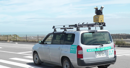
Vehicle-mounted 3D laser scanner
By installing a laser scanner on a vehicle and surveying, it is possible to quickly convert a wide area into 3D point cloud data in a short amount of time, as long as the vehicle can travel over the area.
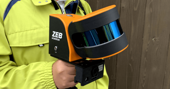
Handheld 3D laser scanner
Even in locations that can only be accessed on foot, such as indoors, forests, and caves, 3D point cloud data can be quickly created in a short time according to the shape of the object being measured.
Futaba TechnologyFutaba's technology
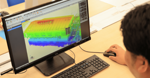
3D point cloud data
We create 3D point cloud data from measurement data obtained by UAV photo point cloud surveying and laser surveying. Detailed information on features and topography can be used as data for various studies.
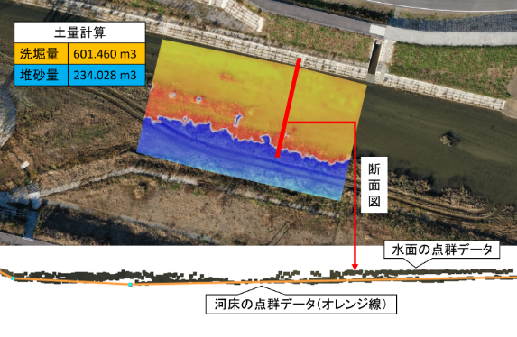
Green laser 3D point cloud data
A green laser that penetrates water can measure underwater conditions and create 3D point cloud data. It can measure depths up to 1.4 times the transparency measured with a 30cm diameter white disk.
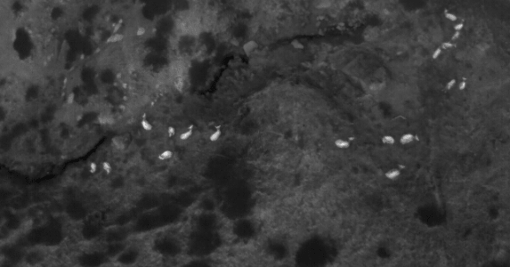
Thermography data
Infrared light allows you to visualize the surface temperature of an object. This can be used to monitor animal behavior, survey populations, and inspect solar panels (the image shows the temperature of a deer).
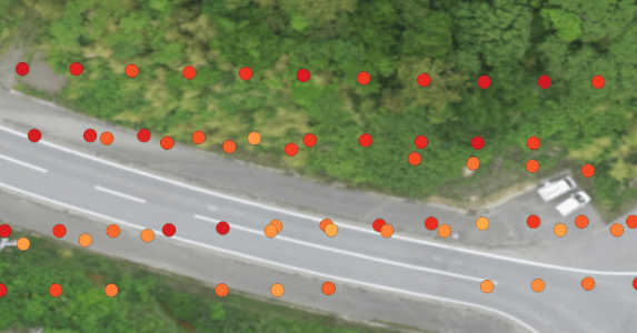
Air dose rate measurement data
Taking into account land cover and topography, the air dose rate at 1 m above ground is estimated from the air dose rate data measured by the UAV.
Based on our many years of experience in the field of surveying and design,
i-Construction and BIM/CIM, etc., tailored to the needs of the times
We proactively incorporate new technologies and offer technical capabilities in a wide range of fields.
Futaba Solution YouTube
UAV-mounted green laser scanner
By installing a green laser scanner on a UAV, it is possible to measure the underwater topography using a green laser that penetrates water. The depth measurement distance depends on the transparency of the water.
UAV-mounted 3D laser scanner
By surveying using a UAV equipped with a near-infrared laser scanner, it is possible to measure 3D point cloud data including the ground surface, even in areas with dense vegetation, as the laser can pass through gaps between the branches and leaves.
Inspection UAV
It can be autonomously controlled even in environments where GPS is not available. It is equipped with an omnidirectional obstacle detection system that utilizes Visual SLAM, which is less susceptible to magnetic interference, allowing for safe close-up photography.
UAV-mounted multi-function camera
Equipped with a wide-angle camera, a zoom camera, a thermal camera, and a laser rangefinder, it can be used for maintaining structures, investigating large animals, and obtaining coordinate information of objects.
Multispectral camera
By installing a multispectral camera on a UAV, it is possible to capture images in five bands (Blue, Green, Red, RedEdge, Near) and is used in forestry and agriculture.
Air dose rate measuring device
It can measure the range of 0.001 to 10 μSv/h with location information at 1-second intervals. Measurements can also be made using a UAV, and values at a height of 1 m above ground can be estimated from UAV measurement data.
Stationary 3D laser scanner
By mounting the laser scanner on a tripod, it is possible to measure 3D point cloud data with higher accuracy and density according to the material and shape of the object being measured.
Vehicle-mounted 3D laser scanner
By installing a laser scanner on a vehicle and surveying, it is possible to quickly convert a wide area into 3D point cloud data in a short amount of time, as long as the vehicle can travel over the area.
Handheld 3D laser scanner
Even in locations that can only be accessed on foot, such as indoors, forests, and caves, 3D point cloud data can be quickly created in a short time according to the shape of the object being measured.
3D point cloud data
We create 3D point cloud data from measurement data obtained by UAV photo point cloud surveying and laser surveying. Detailed information on features and topography can be used as data for various studies.
Green laser 3D point cloud data
A green laser that penetrates water can measure underwater conditions and create 3D point cloud data. It can measure depths up to 1.4 times the transparency measured with a 30cm diameter white disk.
Thermography data
Infrared light allows you to visualize the surface temperature of an object. This can be used to monitor animal behavior, survey populations, and inspect solar panels (the image shows the temperature of a deer).
Air dose rate measurement data
Taking into account land cover and topography, the air dose rate at 1 m above ground is estimated from the air dose rate data measured by the UAV.
Equipment List
-
- Photography UAV
-
- Inspection UAV (autonomous control)
-
- UAV-mounted laser scanner
-
- UAV-mounted green laser
-
- UAV-mounted multi-function camera
-
- Multispectral camera
-
- Air dosimeter (can be mounted on a UAV)
-
- Stationary 3D laser scanner
-
- Vehicle-mounted 3D laser scanner
-
- Handheld 3D laser scanner
-
- 3D printer
-
- Total Station
-
- electronic flat plate
-
- GNSS (Global Navigation Satellite System)
-
- Electronic Level
-
- Auto Level
-
- Autonomous navigation unmanned remote controlled boat equipped with GPS and sonar
-
- Outboard boat/Precision echo sounder