- Technical Topics
Sending gratitude to the other side of the world: A conservation survey project for the Machu Picchu World Heritage site begins.
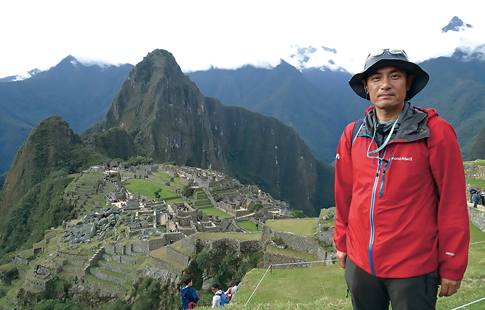
Traveled to Peru from March 3rd to 12th to hold discussions with relevant organizations and conduct on-site surveys in order to advance the Machu Picchu ruins project.
Machu Picchu Village in Peru, South America. This city, famous for being an aerial city, is home to the remains of the ancient Inca Empire, known as the Machu Picchu Ruins. Located at an altitude of approximately 2,450 meters and surrounded by deep forests, many areas remain undiscovered. A conservation survey project has been launched to investigate these mysterious Machu Picchu ruins, using the surveying techniques we have cultivated through reconstruction work after the earthquake. But why did our company become involved in investigating the Machu Picchu ruins? It all comes down to our relationship with Otama Village, which served as an evacuation site for the residents of Tomioka Town during the earthquake. Machu Picchu Village and Otama Village are sister cities, and our participation in this project is also a way for us to give back to Otama Village.

The survey will utilize our drone technology and 3D analysis to capture images of the ruins from the air, including the forest that hides them, in order to derive an overall picture, and we plan to put all our experience and technology to work on the survey.It is an ambitious project that transcends countries and regions and cannot be answered with just pros and cons, but all of our employees and the entire company are working hard on it.